– Transparent Territory
– Vehicle
– Calligraphy and Cartography
– Nearfar Object
– Ecstatic Cartography
– Feral Map
– Vertical Aerial
– Agglomorate
– Depths in Feet
– Garden Carpet / Prayer Carpet
– Sculpture
– Vehicle
– Calligraphy and Cartography
– Nearfar Object
– Ecstatic Cartography
– Feral Map
– Vertical Aerial
– Agglomorate
– Depths in Feet
– Garden Carpet / Prayer Carpet
– Sculpture
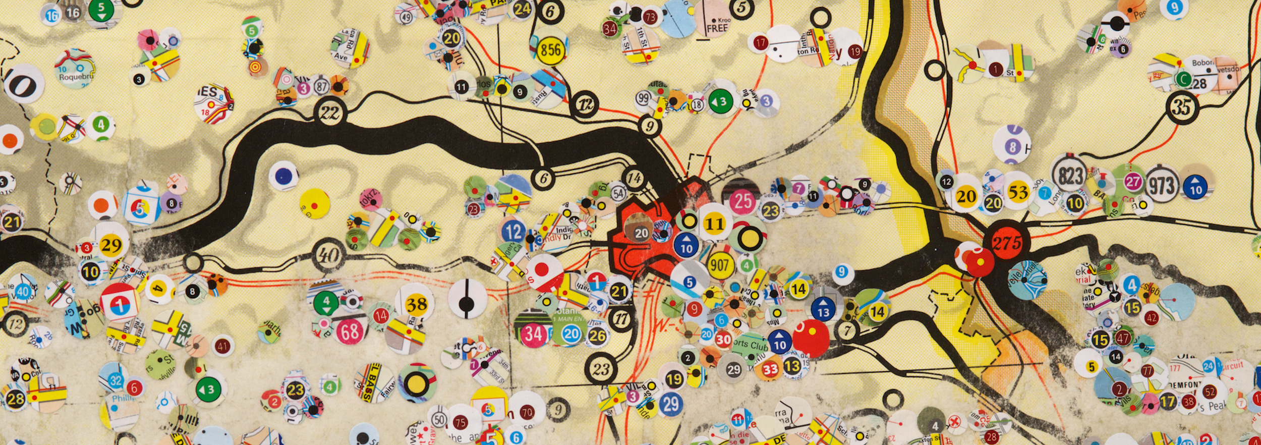
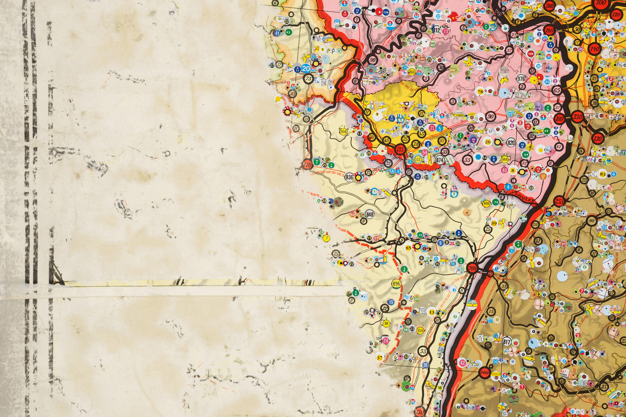
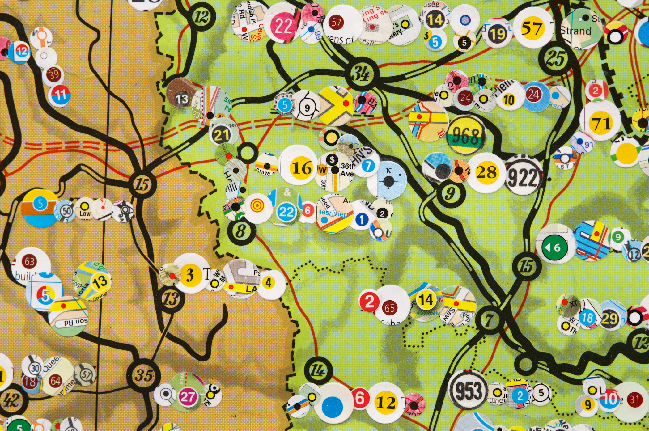
FERAL Map –
Brightly coloured dots are used
within cartographic conventions as markers and indicators of place. On tourist
and transportation maps dots serve to link the geography to its index, to
broader sets of interpretations and functions.
In Feral Map, these markers of place – the dots – where punched and
removed from a wide and arbitrary collection of maps. In turn they were
grafted, dot-by-dot to obscure all legible text on a large
geographic map.
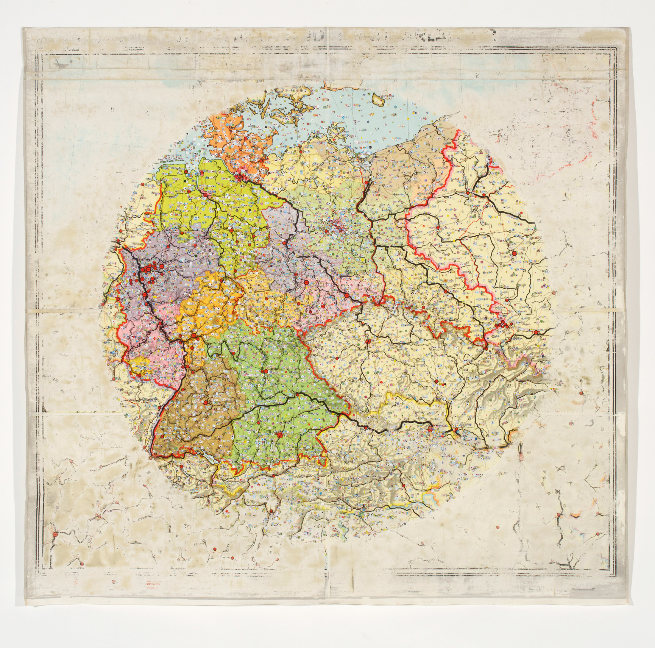
Feral Map, 2015
Markers of place grafted from a selection of maps onto found geographical map
200 X 190cm